Stories: 45 accounts, one place at a time
Every long UmaTerra story in one place, in three sets: 18 thematic accounts of fire, forest, land and climate in Brazil, Canada and the United States; one story for each of Brazil’s 27 capitals; and a series on 108 endangered animals in 70 countries, read through the land use of the place where they live (the 100 endangered plants have a series of their own, 100 stories published so far) (108 published so far). Every account redoes, inside one of the platforms, the very measurements it cites.
How to cite: Biondo, Leandro M. (2026). Histórias. UmaTerra. https://umaterra.com.br/en/stories/
Exploratory stories: generated automatically from the UmaTerra platforms’ data; not independently validated or peer reviewed.
Thematic stories 18
One place or one event per story, sometimes across more than one country and platform.
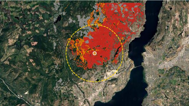 🇨🇦West Kelowna, 2023: one fire through four platformsBurned forest, a regional park, Crown land and the climate ahead, in one story that runs through Naturametrics, Yvynation, Camposcope and climate-shift.Naturametrics · Camposcope · Yvynation · climate-shift
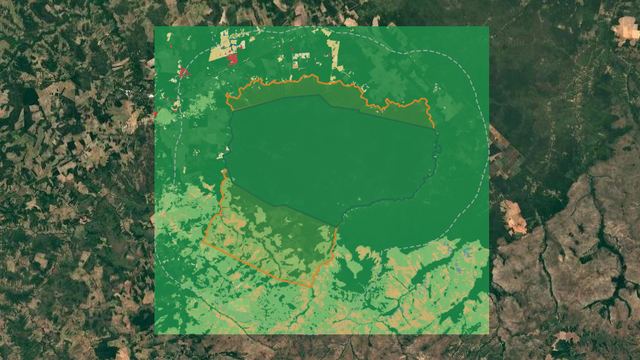 🇧🇷Porquinhos and Bacurizinho: what happens to the land while an extension waitsA detailed case study: Bacurizinho as ratified in 1983, its extension declared in 2008 and neighbouring Porquinhos, and what changed inside them and around.Naturametrics · Camposcope · Yvynation · climate-shift
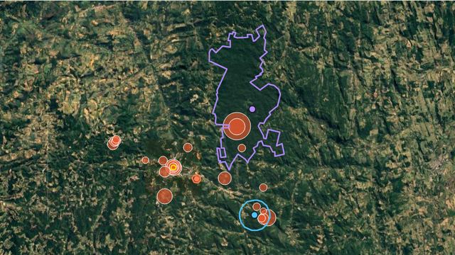 🇧🇷Ruschi's museum: from a smallholding in Santa Teresa to the National Atlantic Forest InstituteOrchids traded for forest in 1939, a museum, a biological station and a federal reserve: four places seen from space from 1985 to 2025, and what GBIF holds for each, and locations it has.Naturametrics · Yvynation
 🇧🇷🇨🇦🇺🇸Three parks, the same tools: Great Smoky, Gros Morne and IguaçuA national park in the United States, one in Canada and one in Brazil, of similar size, read with the same outline, the same tree-cover loss and the same GBIF counts: where the tools agree, where the parks differ, and why a count of records measures observation effort, not richness.Naturametrics · Yvynation
 🇧🇷🇨🇦Who decides about the forest: tenure, rules and the right to cut in Brazil and CanadaWho owns the forest, who makes the rules and who may cut it, read side by side in Pará, Maranhão, Paraná, Espírito Santo and British Columbia: public tenure, protection and private property, with the laws cited, maps at the same scale and land use from 1985 on.Naturametrics · Camposcope · Yvynation
 🇧🇷🇨🇦Who holds the forest, and does it change what happens to it?A lecture page on forest tenure: how Canada and Brazil write down who decides, and the Bacurizinho case in Maranhão, with what the result does and does not say.Yvynation
 🇧🇷🇨🇦What the satellite saw and what is ahead: forest loss, fire and climate in the same Brazil and Canada placesThe places of Who decides about the forest read by satellite since 1985 (tree-cover loss and its cause, fire and biomass) and by projections (heat, drought and fire weather in 2041–2070), with measured and projected always kept apart: exposure, not prediction.climate-shift · Naturametrics · Camposcope · Yvynation
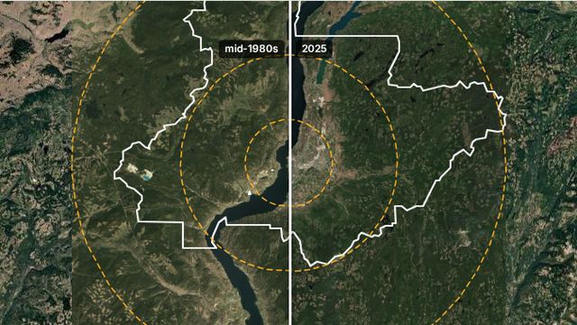 🇧🇷🇨🇦🇺🇸Three growing metros, Houston, Goiânia and Kelowna, and the climate they are growing intoThe same ruler in three countries: the urban footprint from 1975 to 2020, what the growth took, the heat island measured by satellite, and the heat, drought, fire and heavy-rain scenarios in climate-shift, with El Niño, an urban and a rural place in each city, and places drawn by Naturametrics.climate-shift · Camposcope · Naturametrics
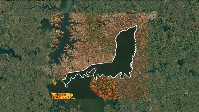
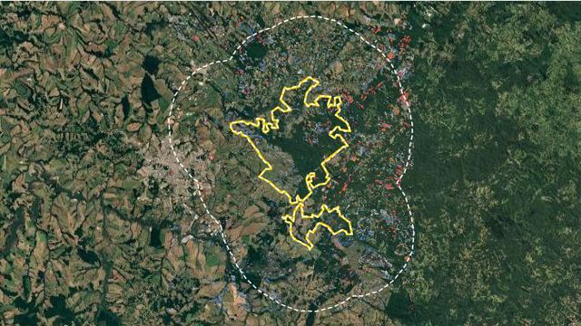 🇧🇷Campos Gerais: a national park and a state park in the same landscapeIn inland Paraná, a federal park created over farmland and a state park around a canyon, in satellite pictures from four eras, with each clearing in the colour of the president of the day, in Yvynation.Yvynation
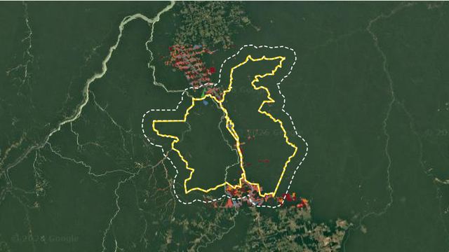 🇧🇷Jamanxim and Martírios: a federal park and a Pará state park, term by termThe same governor stayed through the switch from Bolsonaro to Lula: on the BR-163 clearing rose and fell with the federal government, while on the Araguaia the state park's fire regime changed.Yvynation
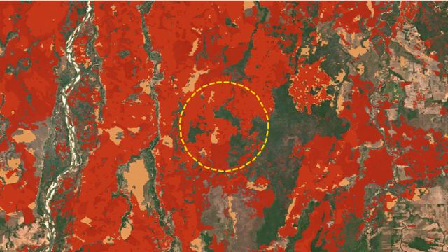 🇧🇷Cerrado, 2024: the fire year, from the whole biome to the Ilha do BananalForty years of fire in the Cerrado from MapBiomas, the 2024 season month by month and class by class, and the Ilha do Bananal, which burned two years running, with the climate and El Niño in climate-shift.climate-shift
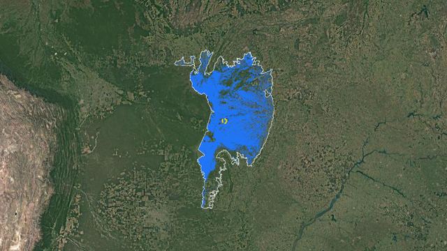 🇧🇷The Pantanal drying out: forty years of water, year by yearThe water of the planet's largest floodplain measured every year since 1985 by MapBiomas: the floods of before, the 2024 drought, the fires and what took the water's place, with the climate ahead in climate-shift.climate-shift
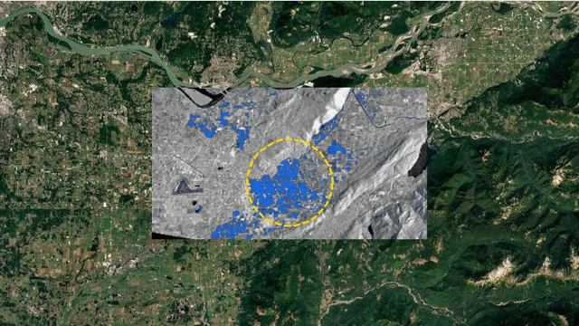 🇨🇦British Columbia, 2021: the atmospheric river that brought a lake backThe Sumas Prairie flood read by radar through the clouds, the rivers at their gauges on both sides of the border, the farms under water, and the climate and La Niña in climate-shift.climate-shift
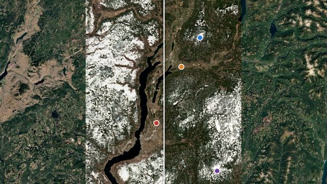 🇨🇦The Okanagan's thinning winters: from Silver Star and Big White to GlacierThe Okanagan's snow on 1 April 2026 was the lowest since 1980, in a La Niña winter. The province's snow bulletin, a reanalysis, stations and satellite at Vernon, Kelowna and Glacier National Park, a test of snow near 0 °C, and an El Niño that may be the strongest ever measured.climate-shift
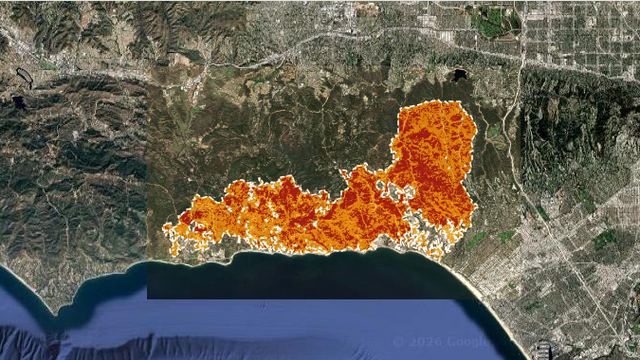 🇺🇸Palisades, 2025: a wildfire that crossed into the cityThe January 2025 Los Angeles fire measured from orbit: what burned, how much of it was town, what the land-cover map recorded and the climate ahead, in climate-shift.climate-shift
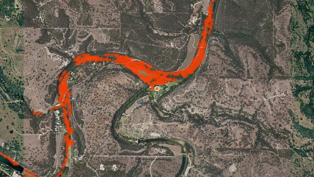 🇺🇸The Guadalupe, 4 July 2025: one night's flood, before and afterThe flood that went through Camp Mystic, Texas, read by the instruments: the rain from orbit, the river at three USGS gauges, the valley before and after from Sentinel-2, and the climate and El Niño in climate-shift.climate-shift
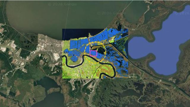 🇺🇸Katrina, 2005: the city under water and what the maps keptNew Orleans nine days after the levees failed, seen by Landsat 5, and what three records of water and land cover show or miss, with the climate ahead in climate-shift.climate-shift
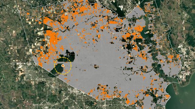 🇺🇸Houston and Harvey: the city that grew over the prairie, and the rain of 2017Forty years of city and wetland in Harris County from the Annual NLCD, Harvey's rain, the bayous past their records and the water seen by radar, with the climate ahead in climate-shift.climate-shift
The capitals 27
Each Brazilian capital has its own story, measured with the same ruler: the capital and the regions of its state, with the INMET stations behind it.
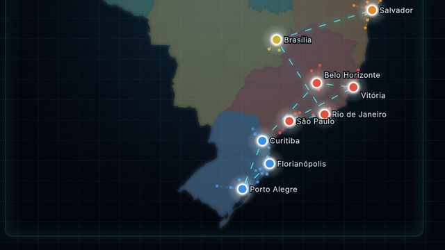 Open the capitals map →The map links each capital to the stations used in its story and compares the 27.Brazil’s capitals: 27 metro areas read with one ruler
Northeast
Endangered animals 108
Each story will read, in Naturametrics, the land-cover change around a place where pictures of a threatened species are recorded in GBIF. The stories are in preparation; the map already shows the places and the species.
 Open the species map →The world map shows the 108 places, with a picture, the IUCN category and the credit of each image.Endangered animals and the history of land use: 108 places around the world
Africa
Asia
- Komodo dragon
- Sunda pangolin
- Bornean orangutan
- Proboscis monkey
- Asian elephant
- Philippine eagle
- White-handed gibbon
- Red-shanked douc
- Chinese pangolin
- Arabian oryx
- Tiger
- Red panda
- Greater one-horned rhinoceros
- Nubian ibex
- Golden snub-nosed monkey
- Crested ibis
- Snow leopard
- Black-faced spoonbill
- Red-crowned crane
- Saker falcon
- Steller's sea eagle
Europe
- Spanish imperial eagle
- Iberian lynx
- Mediterranean monk seal
- Egyptian vulture
- Great bustard
- Hermann's tortoise
- Spur-thighed tortoise
- European turtle dove
- Hermann's tortoise
- European ground squirrel
- Common pochard
- Eastern imperial eagle
- European hamster
- Atlantic puffin
- Aquatic warbler
- Black-legged kittiwake
- Common pochard
- Long-tailed duck
- Long-tailed duck
- Velvet scoter
- Long-tailed duck
Americas
- Huemul
- Darwin's fox
- Humboldt penguin
- Marsh deer
- Golden lion tamarin
- Caetés catfish
- Cherry-throated tanager
- Buffy-headed marmoset
- Maned sloth
- Giant anteater
- Northern muriqui
- Red-billed curassow
- Red-browed amazon
- Red-fronted macaw
- Giant otter
- Hyacinth macaw
- Andean flamingo
- Golden-headed lion tamarin
- Giant otter
- Yellow-breasted capuchin
- Lear's macaw
- Yellow-tailed woolly monkey
- Andean bear
- Giant otter
- Andean condor
- Harpy eagle
- Great green macaw
- Baird's tapir
- Yellow-headed amazon
- Military macaw
- Cuban crocodile
- Whooping crane
- California condor
- Black-footed ferret
- Vancouver Island marmot
- Whooping crane (migration stop-over)
- Caribou
- Polar bear
Names without a link are stories still in preparation.
Endangered plants: 100 stories, 100 published so far, in a series of their own. Open the plant map →